OpenStreetMap Stack 2 Tutorial
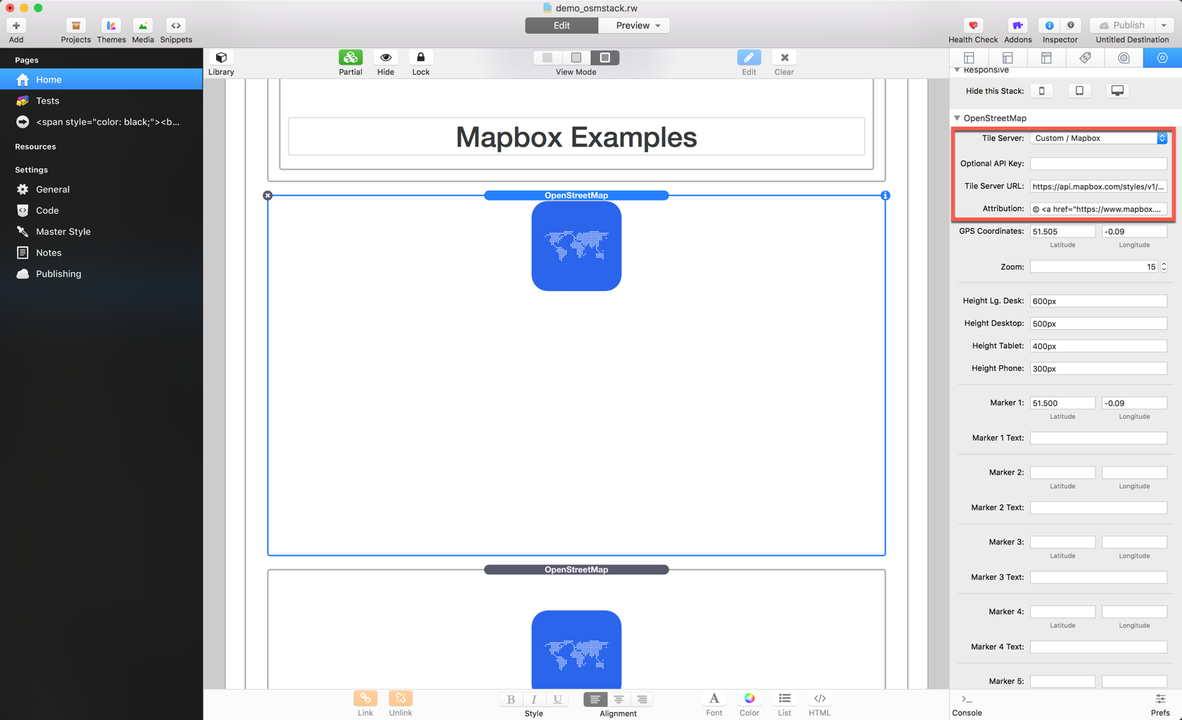
Settings
Map Height: Define the height of the map, either in px, em, or rem
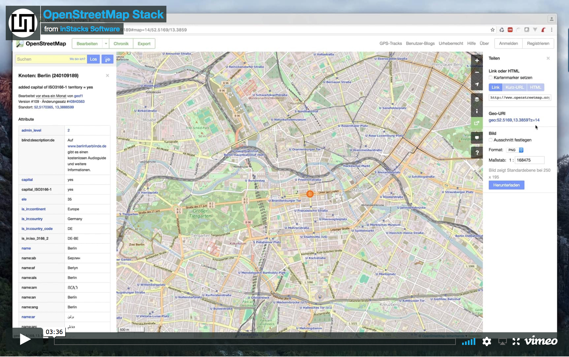
Map Latitute and Longitute: The coordinates for the map center. Check out http://openstreetmap.org/ to find your location.
Zoom: Zoom level, please be aware that different maps have different zoom level starting points, not all maps are available in the highest zoom level
Marker #: Set a pin to your desired coordinates
Marker # Text: An optional popup text for the pin
Marker # Link: An optional link for the marker text
Marker # Color: Color option for the pin
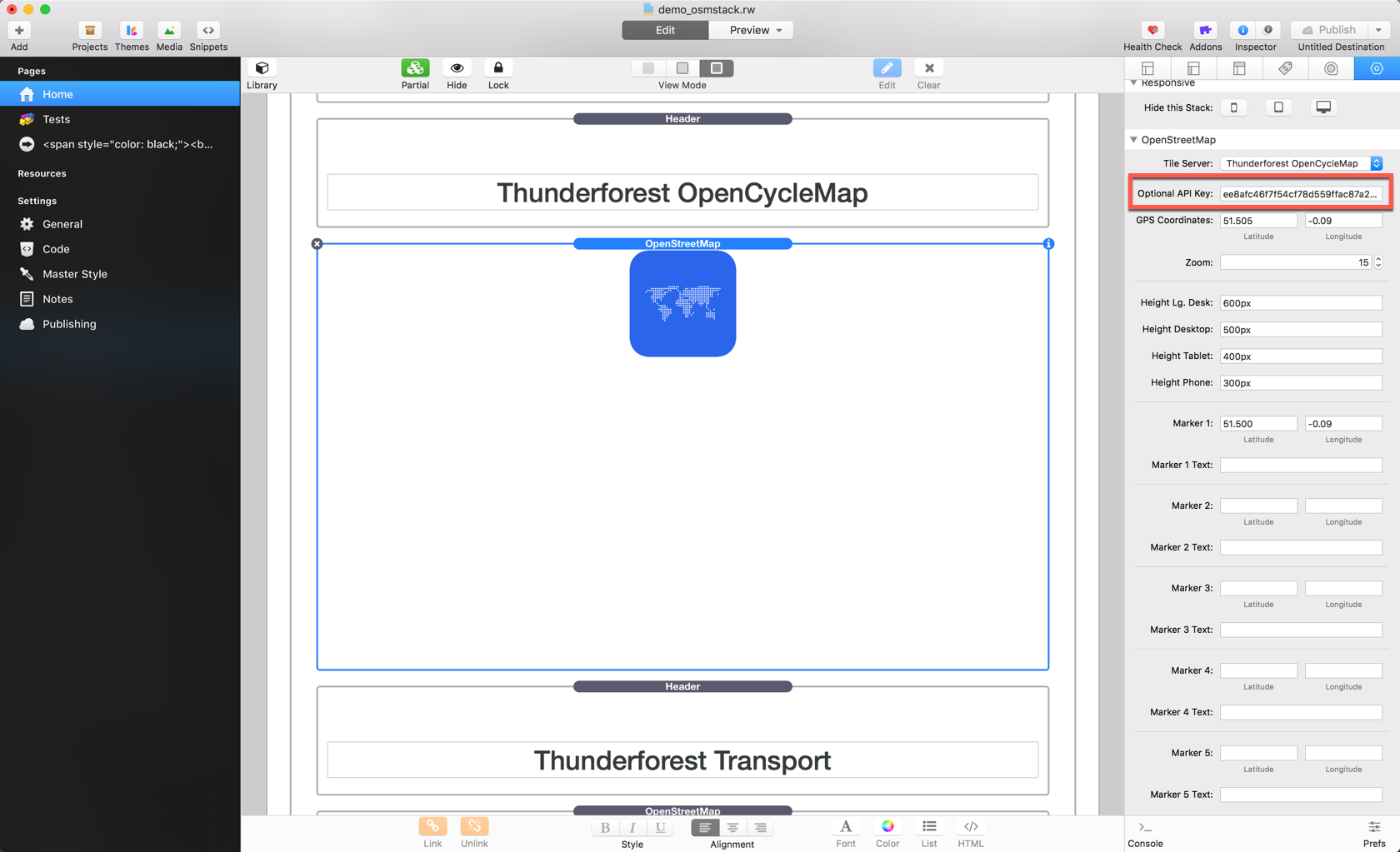
Special Settings for Thunderforest Maps
- Thunderforest needs an API key, which you can get here: https://www.thunderforest.com
- After registration, enter the API key into the Optional API Key input field.
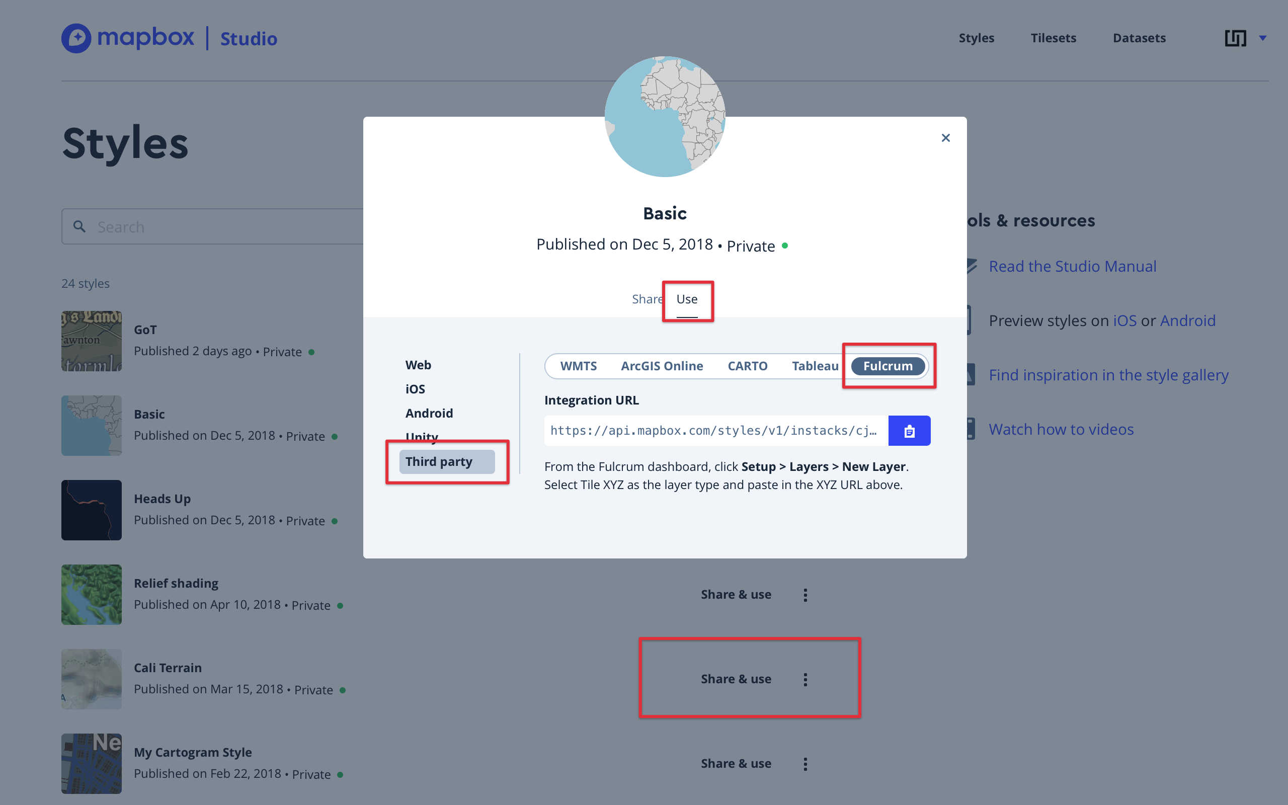
Special Settings for Mapbox Styles
- Mapbox Studio needs a registration, which you can perform here: https://www.mapbox.com/mapbox-studio/
- After registration, create your own styles here: https://www.mapbox.com/studio/styles/
- When finished, navigate to
- Share & use
- Use
- Third party
- Fulcrum
- Copy the full integration URL (including the access token) and paste it into the Tile Server URL input field